Imelda Spares the US Coast
Imelda is the newest tropical storm and is the first system to undergo a drastic change in forecast in the 2023 hurricane season. Initially a concern for the Southeast US coastline, Imelda is now expected to predictably strengthen and turn out to be the first hurricane of the season, but the chances of a Southeast US landfall is significantly reduced.
Impacts from the storm are already being felt across the Bahamas. Coastal areas of Florida and the Southeast, as well as Georgia, the Carolinas, and the Bahamas are preparing for rainfall, strong winds, and coastal flooding.
Where is Imelda now?
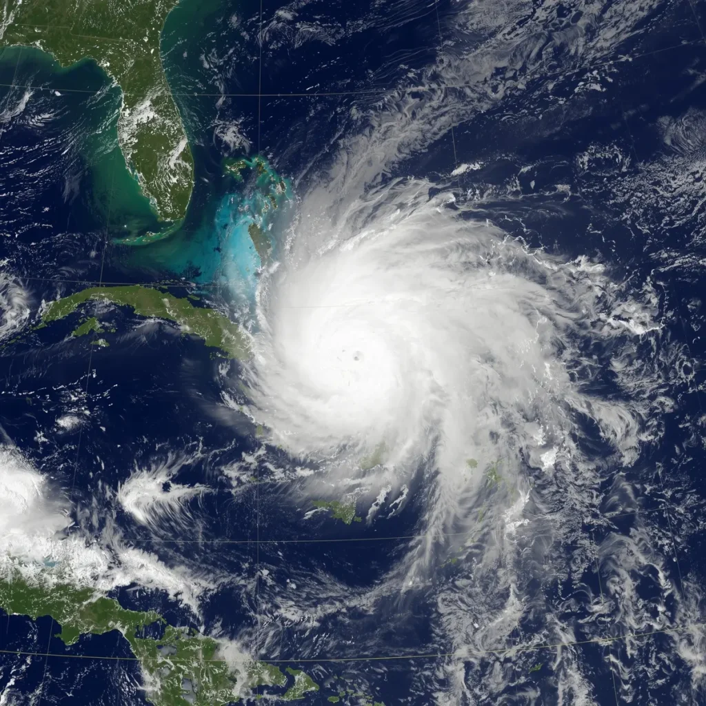
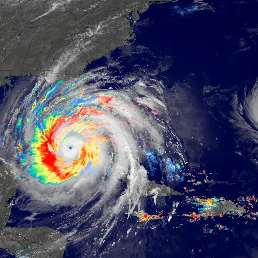
As of the 8 p.m. Eastern Time, Sunday September 10, the National Hurricane Center reported Imelda to be 335 miles Southeast of Cape Canaveral, Florida. Imelda was expected to strengthen into a hurricane early the following week.
Right now, the central and northwestern areas of the Bahamas are under tropical storm warnings as heavy rain creates flooding threats. In the Bahamas and eastern Cuba, rain forecasts for these areas range from 4 to 12 inches which will cause flash flooding.
What Caused the Change in Forecast Track?
In the past 24 to 36 hours, we have seen a major change in the projected path of Tropical Storm Imelda. Previously, forecasted path models indicated the tropical storm would be making landfall somewhere along the Southeastern U.S. coast. New forecast models suggest Imelda will move north, along the coast of Florida, and then make a sharp easterly turn out to the Atlantic.
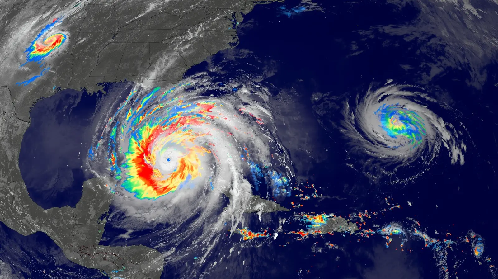
One of Imelda’s influences has been Hurricane Humberto, a major Category 4 storm out in the Atlantic. Imelda has minimally moved, which has allowed Humberto to take more of the influence in the pull, resulting in an “tropical tug-of-war.” Imelda is pulled away from the coast.
Because of this, the NHC has lifted tropical storm watches for the eastern Florida coast. This is a positive change, but officials remind the public that the coast is still under adverse conditions.
Impacts on the U.S. Southeast
Although forecasters expect the center of Tropical Storm Imelda to stay out to sea, the Southeast coast will not get through the week unscathed. Per the National Hurricane Center, residents of Florida, Georgia, and the Carolinas will see gusty winds, elevated surf, and some coastal flooding during the early to midweek period.
Some of the concerns in the Southeast region encompass the following:
Rainfall: Latest forecasts predict rain totals of 2 to 6 inches in the coastal Carolinas through Wednesday morning, an improvement over earlier forecasts.
Onshore winds: These will create high surf and will cause coastal flooding and beach erosion.
Widespread gusts: Tropical Storm Imelda is expected to strengthen, and her winds will cover a large area even though the storm is not expected to make landfall.
Emergency preparations have already begun. South Carolina Gov. Henry McMaster issued a state of emergency on Friday, and the City of Charleston followed suit by declaring a local emergency on Saturday and implementing flood mitigation measures of distributing sandbags and clearing storm drains.
The Role of Hurricane Humberto
While Imelda is in the headlines, Hurricane Humberto is working as a very quiet influence on the season. After explosively intensifying to a rare and brief Category 5 hurricane on Saturday, Humberto has slightly weakened to a high-end Category 4.
Though Humberto poses no direct threat to the U.S., it is accounts for most of the reason that Hurricane Imelda is being pushed away from land. The storm is expected to continue being a powerful hurricane for the next few days and is currently expected to go well to the west of Bermuda. Even so, the island is under a tropical storm watch, as bands of rain and gusty winds may reach the area Tuesday through Wednesday.
It will be interesting to watch how Tropical Storm Imelda may, by the end of the week, add to the complexity of the season by also potentially approaching Bermuda.
Is There Still A Risk In The Southeast?
Even though the southeast region is less likely to receive a direct hit, the NHC encourages people to stay vigilant. The NHC states “The risk of significant wind impacts along the southeastern United States coast is decreasing, but interests in that area should continue to monitor the latest forecast updates.”
Most importantly people in the area should:
- Follow the National Hurricane Center’s updates.
- Be ready for the possibility of flooding.
- Stay off the roads during heavy rain.
- Stay out of the ocean, especially during high tide, and during storms.
- Stay out of the ocean during high tides.
Hurricane Season Still Has Time Left
With the shift of Imelda to a likely hurricane and northeast to the open Atlantic, the continental U.S. threat level is stabilizing. Nevertheless, the outer bands and the expanding wind-field will keep the coast situations.
Hurricane season is still far from over as attention shifts to the larger Atlantic and Humberto is still churning along with other tropical storms that are being watched for possible development. This tells us hurricane season is still far from over.
Final Thoughts
While Tropical Storm Imelda was a less serious threat to the U.S. Southeast, active and unpredictable storm seasons remain. At the moment, the greatest threat is to the Bahamas. Residents of Southeastern U.S. should continue to stay updated and ready.
This unfoldment goes to show the value of weather updates, the need for emergency preparedness, and large systems like Hurricane Humberto and how it affects the movement of other storms.
Stay safe, stay dry, and keep watching the sky.
Reference Website : https://edition.cnn.com/2025/09/28/weather/tropical-storm-hurricane-imelda-humberto-track-climate
Read More Article : theclimatepost.com